What is Interactive World Maps?
Interactive World Maps – Responsive SVG Map WordPress Plugin
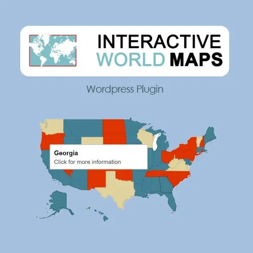
Create engaging, clickable maps for your WordPress website with Interactive World Maps. This powerful mapping plugin allows you to build responsive SVG maps of the world, continents, countries, and individual regions without requiring coding knowledge.
Transform ordinary map images into interactive visual experiences with clickable regions, custom markers, hover tooltips, color controls, legends, popups, and external links. Whether you are building a store locator, travel website, regional directory, territory map, or data visualization, Interactive World Maps helps present geographical information in an attractive and user-friendly format.
Feature Highlights
World, Continent & Country Maps: Create interactive SVG maps covering the world, continents, countries, and regions.
Responsive SVG Maps: Display clear, scalable maps across desktop, tablet, and mobile devices.
Interactive Regions & Markers: Highlight geographical areas and add markers with individual interactions.
Hover Tooltips: Display additional information when visitors move their cursor over map regions or markers.
Custom Click Actions: Configure regions and markers to open URLs, display popups, or launch other supported actions.
Color Controls & Legends: Customize region colors and create legends for categories, states, and data ranges.
Popups & External Links: Connect map elements to external pages, lightboxes, or custom modal windows.
Shortcode Support: Embed interactive maps into different WordPress pages and posts using generated shortcodes.
Gutenberg Block Support: Add maps through the WordPress block editor.
Search & Filter Friendly: Use synchronized lists and filtering options to help visitors find relevant map information.
Performance-Optimized SVG Rendering: Display vector-based maps without relying on third-party map iframes.
Custom Styling: Adjust map colors and visual elements to complement your website design.
Detailed Overview
Interactive World, Continent and Country Maps
Create geographical maps for different purposes, including worldwide coverage, individual continents, countries, and specific regions. Highlight selected areas to make important geographical information easier to understand.
Responsive SVG Map Technology
Interactive World Maps uses SVG-based map graphics to provide scalable visuals. Maps remain sharp when resized, making them suitable for different screen sizes and high-resolution displays.
Interactive Regions and Custom Markers
Highlight individual countries, states, and other supported map regions. Add markers to identify important locations and make geographical information more accessible to visitors.
Hover Tooltips and Location Details
Display additional information when visitors hover over interactive regions or markers. Tooltips can help communicate location names, descriptions, statistics, and other relevant details.
Custom Click Actions
Make map elements interactive by assigning actions to individual regions and markers. Depending on the available configuration, visitors can:
Open an external or internal URL.
Display a popup or modal window.
Launch a lightbox.
View additional location information.
Color Controls and Map Legends
Customize the appearance of geographical regions using different colors. Organize map areas into categories and use legends to help visitors understand the information represented by each color.
Search and Filter-Friendly Navigation
Make location information easier to browse with searchable and filterable lists synchronized with the map. This is useful when displaying multiple regions, destinations, or locations.
WordPress Editor Compatibility
Add interactive maps to your website using shortcode functionality or the Gutenberg block. This makes it convenient to place maps inside posts and pages without manually editing code.
Lightweight SVG Rendering
The plugin uses SVG-based map rendering and avoids third-party map iframes for its map presentation. This provides a streamlined approach to displaying interactive geographical visuals.
Comparison: Interactive World Maps vs. Typical Map Plugins
Capability | Interactive World Maps | Typical Map Plugins |
|---|
SVG responsiveness | Scalable vector maps | May rely on raster images |
Clickable regions | Interactive geographical areas | Often focused on map pins |
Custom markers | Supported | Varies by plugin |
Tooltips and popups | Interactive information display | Varies by plugin |
Custom styling | Region colors and legends | Varies by plugin |
WordPress integration | Shortcodes and Gutenberg block | Depends on plugin |
Map rendering | SVG-based presentation | May use external embeds |